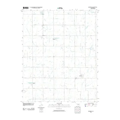
2010 Map of Kendrick
USGS Topo · Published 2010About this map
The small town of Kendrick and the settlement of Parkland anchor this Lincoln County landscape, showing the organized section-line road grid typical of central Oklahoma. The area is defined by a dense network of watercourses, including East Beaver Creek, West Beaver Creek, and Ranch Creek, which feed into several identified water bodies such as Oknoname 08114 Reservoir and Oknoname 08115 Reservoir. This 2010 survey provides essential data for those tracing local family history, as it clearly locates Kendrick Cemetery, Parkland Cemetery, and Bethel Cemetery relative to the early 21st-century road system. The map reflects a rural environment where land use is dictated by the drainage of Turkey Creek and Dry Creek, preserving the names of the small communities and the cemeteries that have served the surrounding agricultural population for generations.
Find a feature on this map
40 named features on this map. Tap any name to fly to it.
Don’t see what you’re looking for? This feature index may not catch every label — zoom into the map to look around manually.
Map Details
Editions of this 2010 Kendrick Map
This is the sole edition of this map. No revisions or reprints were ever made.
Other maps of this area

1905 · Chandler
USGS Topo · 1:62,500

1907 · Chandler
USGS Topo · 1:62,500

1908 · Agra
USGS Topo · 1:62,500

1929 · Stroud
USGS Topo · 1:62,500

1931 · Drumright
USGS Topo · 1:62,500

1932 · Stroud
USGS Topo · 1:62,500

1954 · Oklahoma City
USGS Topo · 1:250,000

1957 · Oklahoma City
USGS Topo · 1:250,000

1963 · Oklahoma City
USGS Topo · 1:250,000
1974 · Chandler
USGS Topo · 1:24,000