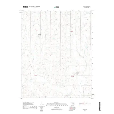
2018 Map of Kendrick
USGS Topo · Published 2018About this map
Kendrick serves as the primary hub for this Lincoln County landscape, showing a classic Oklahoma grid of section roads and small-town street names like Main St. The surrounding countryside is defined by a dense network of watercourses, including Ranch Creek and Beaver Creek, which feed into several local water bodies like 08115 Reservoir. The map provides significant genealogical value through its marking of local burial grounds, notably the Kendrick Cemetery just south of town and the Bethel Cemetery situated further west.
Find a feature on this map
49 named features on this map. Tap any name to fly to it.
Don’t see what you’re looking for? This feature index may not catch every label — zoom into the map to look around manually.
Map Details
Editions of this 2018 Kendrick Map
This is the sole edition of this map. No revisions or reprints were ever made.
Other maps of this area

1905 · Chandler
USGS Topo · 1:62,500

1907 · Chandler
USGS Topo · 1:62,500

1908 · Agra
USGS Topo · 1:62,500

1929 · Stroud
USGS Topo · 1:62,500

1931 · Drumright
USGS Topo · 1:62,500

1932 · Stroud
USGS Topo · 1:62,500

1954 · Oklahoma City
USGS Topo · 1:250,000

1957 · Oklahoma City
USGS Topo · 1:250,000

1963 · Oklahoma City
USGS Topo · 1:250,000
1974 · Chandler
USGS Topo · 1:24,000