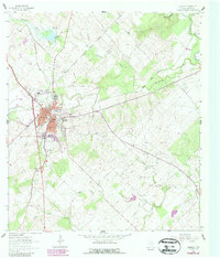
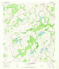
1961 Map of Kenedy
USGS Topo · Published 1987About this map
Kenedy serves as the focal point of this South Texas survey, positioned at a regional crossroads where the Southern Pacific railroad meets local transit routes. The landscape transitions from the urban center to a rural matrix of ranching and industry, marked by an active Oil Field and several quarries scattered throughout the drainage basins of Escondido Creek and Hondo Creek. Cultural markers are abundant, with institutional anchors like the High Sch and Jr High Sch near the town center, while the outskirts are dotted with historic burial grounds including Escondido Cem and Butler Cem. The presence of the Old Grade Railroad and the Karnes County Airport illustrates the evolution of regional transportation. Along the northeastern edge, the San Antonio River carves a winding path, its valley defined by numerous hollows such as Carr Hollow and Possum Hollow.
Find a feature on this map
31 named features on this map. Tap any name to fly to it.
Don’t see what you’re looking for? This feature index may not catch every label — zoom into the map to look around manually.
Map Details
Editions of this 1961 Kenedy Map
3 editions found
Other maps of this area

1936 · Pettus
USGS Topo · 1:62,500

1953 · Beeville
USGS Topo · 1:250,000

1956 · Beeville
USGS Topo · 1:250,000

1956 · Pettus
USGS Topo · 1:62,500

1956 · Karnes City
USGS Topo · 1:62,500

1960 · Beeville
USGS Topo · 1:250,000
1960 · Karnes City
USGS Topo · 1:24,000

1960 · Helena
USGS Topo · 1:24,000
1961 · Kenedy
USGS Topo · 1:24,000
1961 · Lenz
USGS Topo · 1:24,000