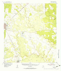
1956 Map of Pettus
USGS Topo · Published 1956About this map
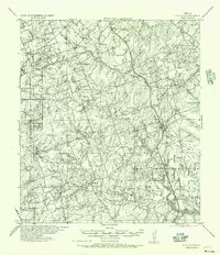
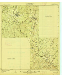
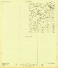
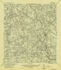
Pettus and the surrounding ranchlands of Bee and Karnes counties appear here during a period of significant petroleum production and rural transition. The Southern Pacific railroad serves as the primary spine for the region, connecting the small trackside communities of Tuleta and Tulsita with the larger hub at Pettus. The landscape is dotted with evidence of the mid-century oil boom, most notably the North Pettus Oil Field and the Ray Oil Field, which share space with established agriculture and family holdings like Page Ranch. Rural education is well-represented through localized landmarks such as Richland School, Ray School, and Cadillac School, many of which were central to these dispersed farming communities. Along the winding courses of Medio Creek and Hondo Creek, dozens of individual homesteads and small settlements like Monteola and Zunkerville are documented by name, providing a detailed record for genealogists and local historians.
Find a feature on this map
58 named features on this map. Tap any name to fly to it.
Don’t see what you’re looking for? This feature index may not catch every label — zoom into the map to look around manually.
Map Details
Editions of this 1956 Pettus Map
This is the sole edition of this map. No revisions or reprints were ever made.
Other maps of this area

1920 · Mikeska
USGS Topo · 1:125,000
1927 · Oakville
USGS Topo · 1:62,500
1931 · Falls City
USGS Topo · 1:62,500
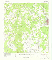
1936 · Pettus
USGS Topo · 1:62,500

1953 · Crystal City
USGS Topo · 1:250,000

1953 · Beeville
USGS Topo · 1:250,000
1954 · Skidmore
USGS Topo · 1:62,500
1954 · Fleming
USGS Topo · 1:62,500

1955 · Crystal City
USGS Topo · 1:250,000

1956 · Suniland
USGS Topo · 1:62,500