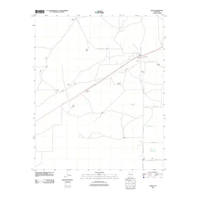
2010 Map of Kenna
USGS Topo · Published 2010About this map
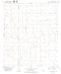
Kenna serves as the focal point of this Roosevelt County landscape, situated along a prominent highway corridor and the intermittent drainage of Kenna Draw. The settlement includes the Kenna Post Office and two distinct burial grounds, Kenna Cemetery and the Old Kenna Cemetery, which offer valuable locations for genealogical research. The surrounding terrain is defined by a series of ephemeral water features and ranching landmarks, including Falsey Draw and the curiously named Doodlebug Windmill. Numerous shallow basins such as Fry Lake, Beaver Lake, and Sealey Lake dot the eastern portion of the quadrangle, illustrating the hydrological character of this high plains region. Dozens of named wells, from the Priewe Well in the north to the Wooden Wheel Well near the southern boundary, highlight the historical reliance on groundwater for the local livestock economy.
Find a feature on this map
33 named features on this map. Tap any name to fly to it.
Don’t see what you’re looking for? This feature index may not catch every label — zoom into the map to look around manually.
Map Details
Editions of this 2010 Kenna Map
This is the sole edition of this map. No revisions or reprints were ever made.
Other maps of this area

1954 · Brownfield
USGS Topo · 1:250,000

1958 · Brownfield
USGS Topo · 1:250,000

1962 · Brownfield
USGS Topo · 1:250,000
1978 · Elida
USGS Topo · 1:24,000

1978 · Curlew Lake
USGS Topo · 1:24,000

1978 · Button Mesa North
USGS Topo · 1:24,000

1979 · Kenna
USGS Topo · 1:24,000
1979 · San Juan Mesa West
USGS Topo · 1:24,000
1979 · Kenna SW
USGS Topo · 1:24,000
1979 · San Juan Mesa East
USGS Topo · 1:24,000