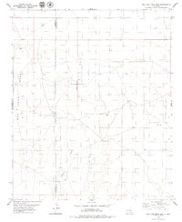
1979 Map of San Juan Mesa East
USGS Topo · Published 1979About this map
San Juan Mesa dominates this corner of the High Plains, where the terrain transitions across the Chaves Co Roosevelt Co boundary. During the late 1970s, the landscape reflects a sparse but active industrial presence, marked by a traversing Pipeline and several infrastructure sites such as a Well and Drill Hole. The elevation of the mesa is utilized for communication, as evidenced by multiple Radio Towers and a singular Radio Tower located at separate points on the plateau. Drainage through this arid environment is channeled primarily through the meandering course of Falsey Draw in the southern portion of the quadrangle. Transportation and utility routes are minimal, though a dedicated Landing Strip suggests the necessity of aerial access for managing the vast ranching or industrial interests in this portion of Roosevelt County.
Find a feature on this map
9 named features on this map. Tap any name to fly to it.
Don’t see what you’re looking for? This feature index may not catch every label — zoom into the map to look around manually.
Map Details
Editions of this 1979 San Juan Mesa East Map
This is the sole edition of this map. No revisions or reprints were ever made.
Other maps of this area

1954 · Clovis
USGS Topo · 1:250,000

1954 · Brownfield
USGS Topo · 1:250,000

1958 · Brownfield
USGS Topo · 1:250,000

1958 · Clovis
USGS Topo · 1:250,000

1962 · Brownfield
USGS Topo · 1:250,000

1973 · Lewiston Lake
USGS Topo · 1:24,000

1973 · Gammil Well SE
USGS Topo · 1:24,000
1973 · Rippee Ranch
USGS Topo · 1:24,000
1978 · Elida
USGS Topo · 1:24,000

1979 · Kenna
USGS Topo · 1:24,000