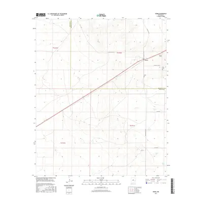
2017 Map of Kenna
USGS Topo · Published 2017About this map
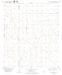
The small settlement of Kenna sits as a lonely outpost on the High Plains, where the border of Roosevelt and Chaves counties meets. This landscape is defined by its subtle drainage patterns and seasonal hydrology, most notably the Kenna Draw and a series of ephemeral basins like Fry Lake, Beaver Lake, and Sealey Lake. These shallow depressions, characteristic of the region, provide the only natural water collection points in a territory dominated by ranching and vast open range. Cultural history is concentrated near the town site, which is served by both the Kenna Cem and the nearby Old Kenna Cem, marking the long-term presence of homesteading families in this arid environment. The map shows a network of strictly utilitarian routes such as Railroad Mountain Rd and Claunch Rd, which connect the scattered rural holdings to the primary corridor passing through the center of Kenna.
Find a feature on this map
22 named features on this map. Tap any name to fly to it.
Don’t see what you’re looking for? This feature index may not catch every label — zoom into the map to look around manually.
Map Details
Editions of this 2017 Kenna Map
This is the sole edition of this map. No revisions or reprints were ever made.
Other maps of this area

1954 · Brownfield
USGS Topo · 1:250,000

1958 · Brownfield
USGS Topo · 1:250,000

1962 · Brownfield
USGS Topo · 1:250,000
1978 · Elida
USGS Topo · 1:24,000

1978 · Curlew Lake
USGS Topo · 1:24,000

1978 · Button Mesa North
USGS Topo · 1:24,000

1979 · Kenna
USGS Topo · 1:24,000
1979 · San Juan Mesa West
USGS Topo · 1:24,000
1979 · Kenna SW
USGS Topo · 1:24,000
1979 · San Juan Mesa East
USGS Topo · 1:24,000