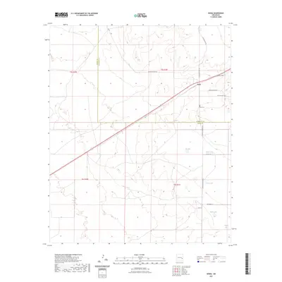
2023 Map of Kenna
USGS Topo · Published 2023About this map
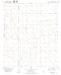
Kenna sits as the central settlement in this eastern New Mexico landscape, positioned where the High Plains transition through various ephemeral drainages. The area is defined by a series of shallow depressions and catchment basins including Fry Lake, Beaver Lake, and Sealey Lake, which punctuate the arid terrain south of the town site. The map documents the persistent infrastructure of the cattle ranching country, with Railroad Mountain RD and Claunch RD connecting remote parcels across the county line. Genealogy and local history researchers will find the locations of both the Kenna Cem and the Old Kenna Cem clearly marked near the banks of Kenna Draw, providing precise coordinates for these local landmarks. The layout reflects a contemporary view of this rural corridor, where Highway 70 serves as the primary artery through the Chaves and Roosevelt county borderlands.
Find a feature on this map
23 named features on this map. Tap any name to fly to it.
Don’t see what you’re looking for? This feature index may not catch every label — zoom into the map to look around manually.
Map Details
Editions of this 2023 Kenna Map
This is the sole edition of this map. No revisions or reprints were ever made.
Other maps of this area

1954 · Brownfield
USGS Topo · 1:250,000

1958 · Brownfield
USGS Topo · 1:250,000

1962 · Brownfield
USGS Topo · 1:250,000
1978 · Elida
USGS Topo · 1:24,000

1978 · Curlew Lake
USGS Topo · 1:24,000

1978 · Button Mesa North
USGS Topo · 1:24,000

1979 · Kenna
USGS Topo · 1:24,000
1979 · San Juan Mesa West
USGS Topo · 1:24,000
1979 · Kenna SW
USGS Topo · 1:24,000
1979 · San Juan Mesa East
USGS Topo · 1:24,000