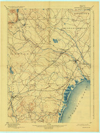
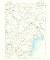
1898 Map of Kennebunk
USGS Topo · Published 1925About this map
Littlefield's Mills and the diverse river systems of York County characterize this late 19th-century coastal landscape. The terrain is defined by the parallel paths of the Mousam River and the Kennebunk River, which supported early industrial activity at sites like Kennebunk Landing. The shoreline transition from the rocky points of Ogunquit to the sandy stretches of Wells Beach and Crescent Surf reveals a coastline beginning to draw seasonal visitors, while the interior remains deeply tied to rail commerce. The dual lines of the Boston and Maine R.R. Western Division and the Eastern Division create a complex network of stops, including Wells Depot and Elms, connecting these inland farming and mill communities to the Atlantic markets. Small settlements like Berwick Branch and North Kennebunkport illustrate the dispersed nature of Maine’s historic town structures before the modern consolidation of commerce.
Find a feature on this map
45 named features on this map. Tap any name to fly to it.
Don’t see what you’re looking for? This feature index may not catch every label — zoom into the map to look around manually.
Map Details
Editions of this 1898 Kennebunk Map
6 editions found

Other maps of this area

1891 · Portland
USGS Topo · 1:62,500

1891 · Biddeford
USGS Topo · 1:62,500

1891 · Berwick
USGS Topo · 1:62,500

1891 · Kennebunk
USGS Topo · 1:62,500

1891 · Buxton
USGS Topo · 1:62,500

1891 · Newfield
USGS Topo · 1:62,500

1892 · Buxton
USGS Topo · 1:62,500

1893 · Kennebunk
USGS Topo · 1:62,500

1893 · Dover
USGS Topo · 1:62,500

1893 · Berwick
USGS Topo · 1:62,500