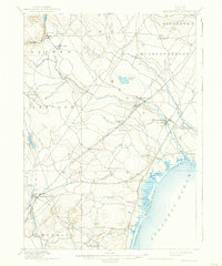
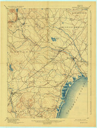
1898 Map of Kennebunk
USGS Topo · Published 1938About this map
The Mousam River and Kennebunk River dictate the settlement patterns of late 19th-century York County, as shown in this reconnaissance-based survey. The landscape is defined by the intersection of traditional coastal industries and the expanding reach of the Boston And Maine Railroad, which operated both an Eastern and Western Division through the region. Significant inland hubs like Wells Depot and West Kennebunk provided vital links for agricultural and timber resources, while smaller milling sites such as Littlefields Mills reflect the localized power of the region's many brooks and branches.
Find a feature on this map
44 named features on this map. Tap any name to fly to it.
Don’t see what you’re looking for? This feature index may not catch every label — zoom into the map to look around manually.
Map Details
Editions of this 1898 Kennebunk Map
6 editions found

Other maps of this area

1891 · Portland
USGS Topo · 1:62,500

1891 · Biddeford
USGS Topo · 1:62,500

1891 · Berwick
USGS Topo · 1:62,500

1891 · Kennebunk
USGS Topo · 1:62,500

1891 · Buxton
USGS Topo · 1:62,500

1891 · Newfield
USGS Topo · 1:62,500

1892 · Buxton
USGS Topo · 1:62,500

1893 · Kennebunk
USGS Topo · 1:62,500

1893 · Dover
USGS Topo · 1:62,500

1893 · Berwick
USGS Topo · 1:62,500