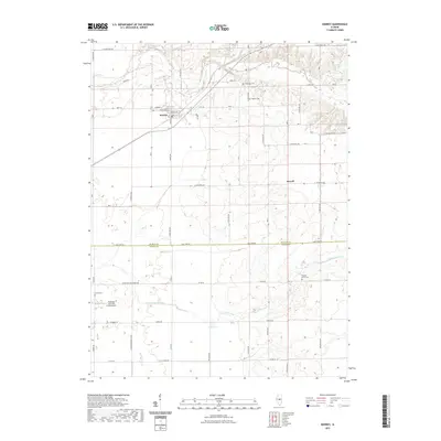
2021 Map of Kenney
USGS Topo · Published 2021About this map
Kenney serves as the central hub of this agricultural landscape in the 2020s, situated at the junction of Kenney Rd and West Rd. The map illustrates a meticulously gridded prairie divided by the county line separating De Witt Co and Macon Co. The northern reaches are defined by the winding course of Salt Creek and Tenmile Cr, where the terrain breaks from the flat farmlands into more varied elevations. For those tracing family histories in the region, several burial sites are documented, including Tunbridge Cem, Wrights Grove Cem, and Baptist Cem. To the south, the landscape is punctuated by Lake Urich and the unique private landing strip at Hayenga's Cant Find Farms Airport, reflecting a mix of traditional central Illinois farming and contemporary land use.
Find a feature on this map
62 named features on this map. Tap any name to fly to it.
Don’t see what you’re looking for? This feature index may not catch every label — zoom into the map to look around manually.
Map Details
Editions of this 2021 Kenney Map
This is the sole edition of this map. No revisions or reprints were ever made.
Other maps of this area

1929 · Decatur
USGS Topo · 1:62,500

1933 · Decatur
USGS Topo · 1:62,500

1954 · Niantic
USGS Topo · 1:62,500

1957 · Kenney
USGS Topo · 1:62,500

1957 · Maroa
USGS Topo · 1:62,500

1958 · Peoria
USGS Topo · 1:250,000

1958 · Decatur
USGS Topo · 1:250,000

1961 · Peoria
USGS Topo · 1:250,000

1961 · Decatur
USGS Topo · 1:250,000

1963 · Peoria
USGS Topo · 1:250,000