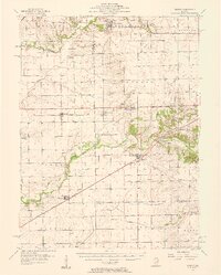
1957 Map of Kenney
USGS Topo · Published 1958About this map
Salt Creek and Kickapoo Creek carve through the landscape of De Witt, Logan, and Macon counties, defining the agricultural character of the region in the late 1950s. The village of Kenney serves as a central hub where the Pennsylvania and Illinois Central railroads intersect, highlighting the era's reliance on rail for moving goods through central Illinois. The sheet captures several smaller settlements and sidings, such as Hallsville, Tabor, and Midland City, many of which developed directly alongside these primary rail corridors.
Find a feature on this map
52 named features on this map. Tap any name to fly to it.
Don’t see what you’re looking for? This feature index may not catch every label — zoom into the map to look around manually.
Map Details
Editions of this 1957 Kenney Map
2 editions found

Other maps of this area

1911 · Lincoln
USGS Topo · 1:62,500

1913 · Lincoln
USGS Topo · 1:62,500

1929 · Decatur
USGS Topo · 1:62,500

1933 · Decatur
USGS Topo · 1:62,500

1949 · Mc Lean
USGS Topo · 1:62,500

1951 · McLean
USGS Topo · 1:62,500

1951 · Minier
USGS Topo · 1:62,500

1951 · Le Roy
USGS Topo · 1:62,500

1954 · Niantic
USGS Topo · 1:62,500

1954 · Mechanicsburg
USGS Topo · 1:62,500