
1907 Map of Keno
USGS Topo · Published 1919About this map
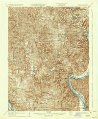
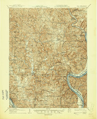
Meigs County's intricate river valleys and upland ridges are captured here during a period of established rural settlement and coal-driven industry. The Ohio West Virginia River anchors the eastern edge of the survey, where the K & M Rr follows the shoreline through Long Bottom and past Portland. Inland, the serpentine Shade River and its forks carve deep into the landscape, connecting communities like Chester and Alfred.
Find a feature on this map
90 named features on this map. Tap any name to fly to it.
Don’t see what you’re looking for? This feature index may not catch every label — zoom into the map to look around manually.
Map Details
Editions of this 1907 Keno Map
3 editions found
Other maps of this area

1902 · Parkersburg
USGS Topo · 1:62,500

1903 · Athens
USGS Topo · 1:62,500

1904 · Parkersburg
USGS Topo · 1:62,500

1904 · Chesterhill
USGS Topo · 1:62,500

1905 · Athens
USGS Topo · 1:62,500

1906 · Belleville
USGS Topo · 1:62,500

1906 · Chesterhill
USGS Topo · 1:62,500

1907 · Pomeroy
USGS Topo · 1:62,500

1907 · Ripley
USGS Topo · 1:62,500

1908 · Ravenswood
USGS Topo · 1:62,500