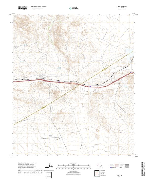
2022 Map of Kent
USGS Topo · Published 2022About this map
Kent sits at a crossroads of high-desert geography and infrastructure where the boundaries of Culberson County and Jeff Davis County meet. This West Texas landscape is defined by its drainage systems and water management, featuring numerous named washes such as Kent Draw, Iron Mountain Draw, and Adobe Draw. Higher elevations are marked by the Apache Mountains to the north and Kent Mtn to the south, while the small settlement of Kent is anchored by the Kent Cemetery. The presence of Rancho Del Cielo Airport and a network of ranch roads including Nelson Letsco Ranch Rd and Kent Rd indicate the region's continued focus on large-scale landholdings. Notable water features like Tidwell Tank, In and Out Tank, and Levinson Reservoir highlight the critical role of water catchment in this arid environment.
Find a feature on this map
27 named features on this map. Tap any name to fly to it.
Don’t see what you’re looking for? This feature index may not catch every label — zoom into the map to look around manually.
Map Details
Editions of this 2022 Kent Map
This is the sole edition of this map. No revisions or reprints were ever made.
Other maps of this area

1894 · Valentine
USGS Topo · 1:125,000

1897 · Valentine
USGS Topo · 1:125,000

1928 · Kent
USGS Topo · 1:125,000

1943 · Valentine
USGS Topo · 1:125,000

1954 · Van Horn
USGS Topo · 1:250,000

1958 · Van Horn
USGS Topo · 1:250,000

1959 · Marfa
USGS Topo · 1:250,000

1965 · Marfa
USGS Topo · 1:250,000
1970 · Panther Canyon
USGS Topo · 1:24,000
1970 · San Martine
USGS Topo · 1:24,000