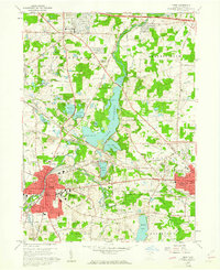
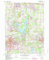
1960 Map of Kent
USGS Topo · Published 1961About this map
Kent State University and the industrial corridors of Kent and Ravenna anchor this 1960 landscape, where the Cuyahoga River feeds the expansive Lake Rockwell reservoir. The map reveals a post-war transition in Portage County, as suburban developments in Streetsboro begin to frame the older rail-and-water networks. Multiple major lines, including the Pennsylvania Railroad and Erie-Lackawanna, crisscross the territory, serving established industrial zones and gravel operations. Local history is deeply etched into the terrain through family and community landmarks like Standing Rock Cem, Riverside Cem, and Stewart Pond. Between the growing city centers, the landscape is dotted with recreational and institutional sites, from the Drive-in Theater near Black Horse to the wooded tracts of the Reservation and Lake Pippen.
Find a feature on this map
58 named features on this map. Tap any name to fly to it.
Don’t see what you’re looking for? This feature index may not catch every label — zoom into the map to look around manually.
Map Details
Editions of this 1960 Kent Map
5 editions found
Other maps of this area

1905 · Garrettsville
USGS Topo · 1:62,500

1906 · Kent
USGS Topo · 1:62,500

1906 · Chagrin Falls
USGS Topo · 1:62,500

1906 · Ravenna
USGS Topo · 1:62,500

1907 · Garrettsville
USGS Topo · 1:62,500

1908 · Chagrin Falls
USGS Topo · 1:62,500

1908 · Ravenna
USGS Topo · 1:62,500

1950 · Cleveland
USGS Topo · 1:250,000

1953 · Aurora
USGS Topo · 1:24,000

1953 · Twinsburg
USGS Topo · 1:24,000