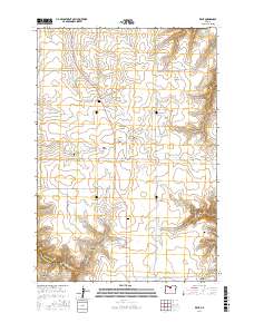
2017 Map of Kent
USGS Topo · Published 2017About this map
Kent serves as the central hub of this Sherman County landscape, surrounded by an intricate network of deep canyons and seasonal water sources. The topography is defined by significant drainage systems, including Finnegan Cr and Buck Hollow Cr, which have carved out notable features like Jackknife Canyon and Kelsay Canyon. These geological formations dictated the placement of early infrastructure, such as Von Borstel RD and Horseshoe Bend RD, which wind along the plateau edges. Local genealogy is well-preserved through several burial sites, including the Kent IOOF Cem near the town center, and the more secluded Wilcox Cem and Daugherty Family Cem located to the southeast. Water management is evident through the presence of Wilson Reservoir and Wilson Reservoir Number Two, essential landmarks in this arid high-desert environment where springs like Crocker Spring and Holman Spring provided critical resources for early inhabitants.
Find a feature on this map
36 named features on this map. Tap any name to fly to it.
Don’t see what you’re looking for? This feature index may not catch every label — zoom into the map to look around manually.
Map Details
Editions of this 2017 Kent Map
This is the sole edition of this map. No revisions or reprints were ever made.
Other maps of this area

1953 · The Dalles
USGS Topo · 1:250,000

1956 · The Dalles
USGS Topo · 1:250,000

1957 · The Dalles
USGS Topo · 1:250,000

1962 · Grass Valley
USGS Topo · 1:24,000

1970 · Indian Cove
USGS Topo · 1:24,000

1970 · Kent
USGS Topo · 1:24,000

1970 · Macken Canyon
USGS Topo · 1:24,000

1970 · Rosebush
USGS Topo · 1:24,000
1971 · Bath Canyon
USGS Topo · 1:24,000
1971 · Horseshoe Bend
USGS Topo · 1:24,000