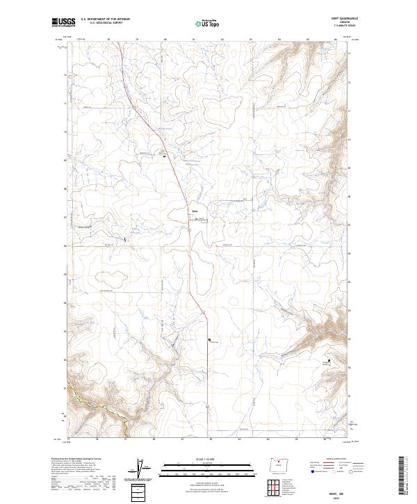
2023 Map of Kent
USGS Topo · Published 2023About this map
Kent serves as the central hub of this high-plateau landscape, where the agricultural grid meets the deep incisions of the surrounding drainage systems. The survey reveals a community deeply rooted in its local history, evidenced by three distinct burial grounds: the Kent IOOF Cem, the Wilcox Cem, and the private Daugherty Family Cem located near the head of Daugherty Canyon. Water management is critical in this environment, shown by infrastructure like Wilson Reservoir Number Two, Wilson Reservoir, and the smaller Borstel Pond. The southern edge of the map is defined by the dramatic descent into Buck Hollow and the complex terrain of Rock Corral Canyon, providing a sharp contrast to the straight section lines of Von Borstel RD and Wilcox LN that crisscross the wheat country above.
Find a feature on this map
74 named features on this map. Tap any name to fly to it.
Don’t see what you’re looking for? This feature index may not catch every label — zoom into the map to look around manually.
Map Details
Editions of this 2023 Kent Map
This is the sole edition of this map. No revisions or reprints were ever made.
Other maps of this area

1953 · The Dalles
USGS Topo · 1:250,000

1956 · The Dalles
USGS Topo · 1:250,000

1957 · The Dalles
USGS Topo · 1:250,000

1962 · Grass Valley
USGS Topo · 1:24,000

1970 · Indian Cove
USGS Topo · 1:24,000

1970 · Kent
USGS Topo · 1:24,000

1970 · Macken Canyon
USGS Topo · 1:24,000

1970 · Rosebush
USGS Topo · 1:24,000
1971 · Bath Canyon
USGS Topo · 1:24,000
1971 · Horseshoe Bend
USGS Topo · 1:24,000