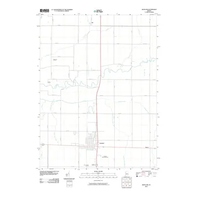
2010 Map of Kentland
USGS Topo · Published 2010About this map
Kentland serves as the central hub of this agricultural landscape in northwestern Indiana, where a grid of rural roads and an extensive network of drainage ditches support the local economy. The winding Iroquois River cuts across the northern half of the area, bordered by significant local landmarks such as Dorne Cemetery and Mount Zion Cemetery. To the south, the settlement pattern concentrates around Kentland, featuring the Kentland Municipal Airport and multiple burial grounds including Fairlawn Cemetery and Saint Josephs Cemetery. The map captures a high degree of hydrological engineering designed to manage the flat prairie land, evidenced by named channels like Montgomery Ditch and Kent Ditch. These man-made watercourses reflect the region's long-standing commitment to reclaiming fertile soil for cultivation, while smaller settlements like Ade and Newton mark the quiet corners of the county.
Find a feature on this map
48 named features on this map. Tap any name to fly to it.
Don’t see what you’re looking for? This feature index may not catch every label — zoom into the map to look around manually.
Map Details
Editions of this 2010 Kentland Map
This is the sole edition of this map. No revisions or reprints were ever made.
Other maps of this area

1935 · Watseka
USGS Topo · 1:48,000

1938 · Milford
USGS Topo · 1:48,000

1939 · Watseka
USGS Topo · 1:62,500

1944 · Milford
USGS Topo · 1:62,500

1953 · Danville
USGS Topo · 1:250,000

1955 · Danville
USGS Topo · 1:250,000

1956 · Danville
USGS Topo · 1:250,000

1961 · Kentland
USGS Topo · 1:24,000

1961 · Mount Ayr
USGS Topo · 1:24,000

1961 · Morocco
USGS Topo · 1:24,000