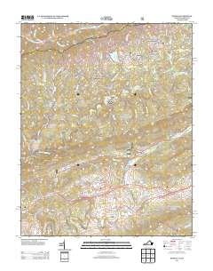
2013 Map of Keokee
USGS Topo · Published 2013About this map
Dryden sits as a central hub in this Appalachian corridor where the Powell River and Poor Valley Creek converge. The landscape is defined by its deep hollows and narrow gaps, such as Trace Gap and Darty Gap, which have historically dictated the movement of goods and people between Virginia and Kentucky. Settlements like Keokee, Calvin, and the smaller Darnell Town are linked by winding routes like the Old US Highway 58 Alternate. The map records traditional river crossings such as Stallard Ford and De Busk Ford, indicating the importance of these points before modern bridging. High points like the Olinger Lookout Tower provide a geographic anchor for the region, while numerous family-named landmarks like McConnell Hollow and Parsons Hollow offer vital clues for genealogists tracing local ancestral landholdings.
Find a feature on this map
123 named features on this map. Tap any name to fly to it.
Don’t see what you’re looking for? This feature index may not catch every label — zoom into the map to look around manually.
Map Details
Editions of this 2013 Keokee Map
This is the sole edition of this map. No revisions or reprints were ever made.
Other maps of this area

1887 · Jonesville
USGS Topo · 1:125,000

1891 · Jonesville
USGS Topo · 1:125,000

1894 · Estillville
USGS Topo · 1:125,000

1916 · Nolansburg
USGS Topo · 1:48,000

1919 · Nolansburg
USGS Topo · 1:62,500

1921 · Big Stone Gap
USGS Topo · 1:48,000

1922 · Big Stone Gap
USGS Topo · 1:62,500

1929 · Big Stone Gap
USGS Topo · 1:62,500
1935 · Appalachia
USGS Topo · 1:24,000
1935 · Ben Hur
USGS Topo · 1:24,000