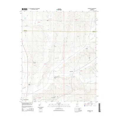
2015 Map of Keownville
USGS Topo · Published 2015About this map
The Little Tallahatchie River meanders across this landscape north of New Albany, dividing the terrain between Union and Tippah counties. This 2015 record shows a rural landscape defined by historic family and community landmarks, particularly concentrated around the small settlements of Keownville, Pleasant Hill, and Molino. The density of cemeteries, including Ebenezer Cem, Concord Cem, and Wells Chapel Cem, provides a detailed map of the area’s genealogical heritage. Numerous tributaries like Pinhook Cr and Wilhite Cr drain into the river valley, while a network of county roads connects established locales such as Locust Grove and Bluff. The survey captures the enduring settlement patterns of northeast Mississippi, where small hamlets remain clustered around their respective churches and burial grounds.
Find a feature on this map
96 named features on this map. Tap any name to fly to it.
Don’t see what you’re looking for? This feature index may not catch every label — zoom into the map to look around manually.
Map Details
Editions of this 2015 Keownville Map
This is the sole edition of this map. No revisions or reprints were ever made.
Other maps of this area

1949 · New Albany
USGS Topo · 1:62,500

1951 · New Albany
USGS Topo · 1:62,500

1955 · Ripley
USGS Topo · 1:62,500

1955 · Sherman
USGS Topo · 1:62,500

1955 · Blue Mountain
USGS Topo · 1:62,500

1956 · Tupelo
USGS Topo · 1:250,000

1958 · Tupelo
USGS Topo · 1:250,000

1980 · New Albany West
USGS Topo · 1:24,000
1980 · New Albany East
USGS Topo · 1:24,000
1980 · Ellistown
USGS Topo · 1:24,000