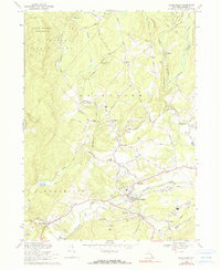
1969 Map of Kerhonkson
USGS Topo · Published 1990About this map
Rondout Creek carves a deep valley through this portion of Ulster County, where the industrial and transport infrastructure of the late 1960s meets the edge of the Catskill Park. The village of Kerhonkson serves as a primary hub, situated near the Kerhonkson Reservoir and the subterranean route of the Delaware Aqueduct. The landscape transition is marked by the contrast between the valley floor settlements and the rising terrain of the State Forest Preserve to the north. Smaller, family-named hamlets like Cherrytown, Mombaccus, and Pataukunk are linked by winding routes such as Samsonville Road and Turnpike Road. Local aviation is represented by Sages Airfield, while the area's educational and social history is anchored by sites like the Liebhardt Sch. The map also captures numerous watercourses including the Vernooey Kill and its Vernooey Falls, highlighting the region's complex drainage system.
Find a feature on this map
60 named features on this map. Tap any name to fly to it.
Don’t see what you’re looking for? This feature index may not catch every label — zoom into the map to look around manually.
Map Details
Editions of this 1969 Kerhonkson Map
2 editions found
Other maps of this area

1901 · Rosendale
USGS Topo · 1:62,500

1903 · Newburg
USGS Topo · 1:62,500

1903 · Rosendale
USGS Topo · 1:62,500

1903 · Slide Mountain
USGS Topo · 1:62,500

1904 · Ellenville
USGS Topo · 1:62,500

1905 · Slide Mountain
USGS Topo · 1:62,500

1906 · Ellenville
USGS Topo · 1:62,500

1942 · West Shokan
USGS Topo · 1:24,000
1942 · Ashokan
USGS Topo · 1:24,000

1942 · Lackawack
USGS Topo · 1:24,000