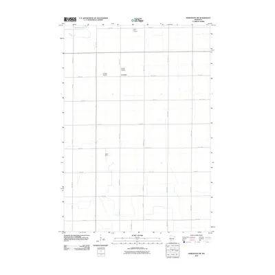
2010 Map of Kerkhoven SW
USGS Topo · Published 2010About this map
Louriston is the central settlement in this agricultural section of Chippewa County, where a grid of rural roads connects scattered farmsteads and communal gathering points. The landscape is marked by the presence of three distinct burial grounds—the Louriston Township Cemetery, Swedish Lutheran Cemetery, and Buffalo Lake Cemetery—which serve as enduring links to the area's early families and pioneer heritage. In the northwestern corner, Shakopee Lake provides a natural break in the terrestrial geometry of sections and ranges. The map also identifies Winter Strip, suggesting local aviation infrastructure within this prairie setting. The orderly arrangement of routes like 70th St NE and 60th Ave NE reflects the systematic land divisions that have defined this region since the original land surveys.
Find a feature on this map
26 named features on this map. Tap any name to fly to it.
Don’t see what you’re looking for? This feature index may not catch every label — zoom into the map to look around manually.
Map Details
Editions of this 2010 Kerkhoven SW Map
This is the sole edition of this map. No revisions or reprints were ever made.
Other maps of this area

1953 · New Ulm
USGS Topo · 1:250,000

1953 · Saint Cloud
USGS Topo · 1:250,000

1957 · Saint Cloud
USGS Topo · 1:250,000

1957 · New Ulm
USGS Topo · 1:250,000

1958 · New Ulm
USGS Topo · 1:250,000

1958 · Saint Cloud
USGS Topo · 1:250,000

1958 · Murdock
USGS Topo · 1:24,000

1958 · Gracelock NE
USGS Topo · 1:24,000

1958 · Kerkhoven SE
USGS Topo · 1:24,000

1958 · Kerkhoven
USGS Topo · 1:24,000