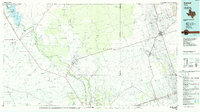
1986 Map of Kermit
USGS Topo · Published 1986About this map
Kermit and the surrounding Permian Basin oil fields define the landscape of this mid-1980s West Texas study. The map centers on the industrial and energy hubs of Winkler and Ward counties, where an extensive network of Oil Field and Gas Field operations stretches across the high desert. Along the western edge, the Pecos River snakes through the terrain, feeding into the Red Bluff Reservoir near the New Mexico border.
Find a feature on this map
34 named features on this map. Tap any name to fly to it.
Don’t see what you’re looking for? This feature index may not catch every label — zoom into the map to look around manually.
Map Details
Editions of this 1986 Kermit Map
2 editions found
Other maps of this area

1921 · Toyah
USGS Topo · 1:125,000

1925 · Orla 2-b
USGS Topo · 1:48,000

1928 · Kent
USGS Topo · 1:125,000

1931 · Barstow
USGS Topo · 1:125,000

1931 · Orla
USGS Topo · 1:62,500

1945 · Malaga
USGS Topo · 1:62,500

1946 · Malaga
USGS Topo · 1:62,500

1954 · Carlsbad
USGS Topo · 1:250,000

1954 · Hobbs
USGS Topo · 1:250,000

1954 · Van Horn
USGS Topo · 1:250,000