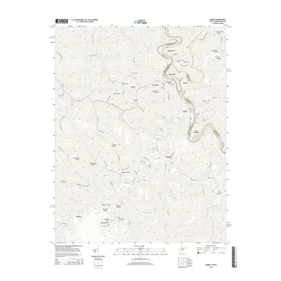
2014 Map of Kermit
USGS Topo · Published 2014About this map
Tug Fork carves a winding path along the state line, defining the border between Martin County, Kentucky, and Mingo County, West Virginia. This 2014 survey documents the enduring connection between the twin communities of Warfield and Kermit, where the local economy and geography are closely tied to the river and the rail infrastructure passing through Number 1 Tunnel, Number 2 Tunnel, and Number 3 Tunnel. The map reveals a deeply etched landscape of hollows and ridges, from Schoolhouse Hollow in the north to Sycamore Hollow in the south.
Find a feature on this map
106 named features on this map. Tap any name to fly to it.
Don’t see what you’re looking for? This feature index may not catch every label — zoom into the map to look around manually.
Map Details
Editions of this 2014 Kermit Map
This is the sole edition of this map. No revisions or reprints were ever made.
Other maps of this area

1886 · Prestonsburg
USGS Topo · 1:125,000

1887 · Warfield
USGS Topo · 1:125,000

1891 · Warfield
USGS Topo · 1:125,000

1892 · Prestonsburg
USGS Topo · 1:125,000

1910 · Naugatuck
USGS Topo · 1:48,000

1912 · Naugatuck
USGS Topo · 1:62,500

1914 · Laynesville
USGS Topo · 1:48,000

1914 · Inez
USGS Topo · 1:48,000

1915 · Williamson
USGS Topo · 1:48,000

1915 · Naugatuck
USGS Topo · 1:48,000