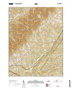
1977 Map of Keswick
USGS Topo · Published 1982About this map
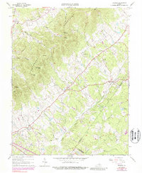
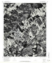
Keswick and the surrounding Albemarle County countryside are captured in this orthophotograph produced by the U.S. Geological Survey in cooperation with the Soil Conservation Service. This specific 1977 aerial imagery provides a direct look at the agricultural patterns and wooded estates of the Southwest Mountains region during the late 1970s. The settlement of Cismont occupies a central position, while Stony Point and Cash Corner mark the rural crossroads that define the local geography north of the Mechunk Creek drainage. Unlike traditional line-drawn maps, this photo-rectified survey shows the precise extent of forest cover and field boundaries, making it an excellent resource for studying land use transitions in the Virginia Piedmont. The rail corridor passing through Cobham and Keswick remains a primary orienting feature across this landscape of rolling farms and historic hamlets.
Find a feature on this map
6 named features on this map. Tap any name to fly to it.
Don’t see what you’re looking for? This feature index may not catch every label — zoom into the map to look around manually.
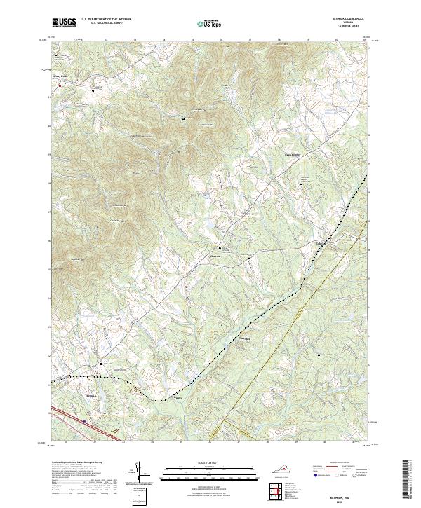
Map Details
Editions of this 1977 Keswick Map
This is the sole edition of this map. No revisions or reprints were ever made.
Historical Maps of Rivanna Through Time
7 maps found