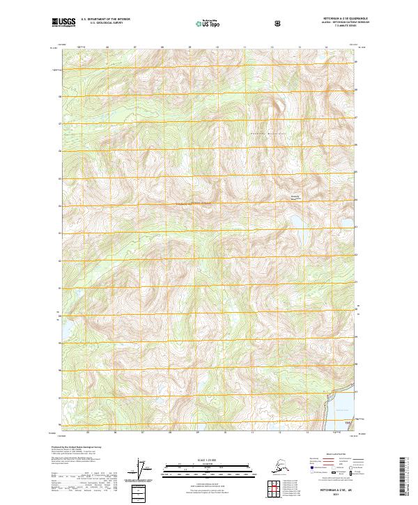
2021 Map of Ketchikan A-2 SE
USGS Topo · Published 2021About this map
Peabody Mountains dominate the interior of this coastal Alaskan landscape, where steep elevations rise sharply from the water's edge. The area is protected as part of the Tongass National Forest, preserving a wilderness defined by its complex drainage systems and maritime climate. To the north, the Red River carves through the mountain valleys, while the southeastern corner is marked by the shoreline of Hidden Inlet. This map captures a remote section of the Alexander Archipelago at the height of modern surveying, documenting the intersection of significant topographic relief and tidal waters. The lack of roads or established settlements emphasizes the character of this region as a maritime-accessible wilderness, where the geography is shaped by glaciers and high-volume precipitation rather than human infrastructure.
Find a feature on this map
8 named features on this map. Tap any name to fly to it.
Don’t see what you’re looking for? This feature index may not catch every label — zoom into the map to look around manually.
Map Details
Editions of this 2021 Ketchikan A-2 SE Map
This is the sole edition of this map. No revisions or reprints were ever made.
Other maps of this area

1951 · Prince Rupert
USGS Topo · 1:250,000

1952 · Ketchikan
USGS Topo · 1:250,000

1955 · Ketchikan A-2
USGS Topo · 1:63,360

1955 · Ketchikan A-1
USGS Topo · 1:63,360

1955 · Prince Rupert D-2
USGS Topo · 1:63,360
1955 · Prince Rupert D-1
USGS Topo · 1:63,360

1955 · Ketchikan
USGS Topo · 1:250,000

1959 · Prince Rupert
USGS Topo · 1:250,000

1964 · Prince Rupert
USGS Topo · 1:250,000
2018 · Ketchikan A-1 NW
USGS Topo · 1:25,000