
1955 Map of Prince Rupert D-2
USGS Topo · Published 1960About this map
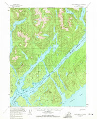
Pearse Canal defines the international boundary between Alaska and British Columbia, cutting through a landscape of deep fjords and maritime passages during the mid-1950s. This survey, conducted as the Tongass National Forest was being mapped for commercial and navigation purposes, reveals the strategic importance of the United States-Canada border markers along the waterways. A solitary Cannery at the mouth of Hidden Inlet hints at the industrial fishing economy that drove settlement in this coastal wilderness. The complex geography of Fillmore Island and Wales Island is detailed with precision, showing the intricate network of channels like Edward Passage and Winter Inlet that provided shelter for vessels navigating the Portland Inlet. Numerous reference monuments along the shorelines serve as critical anchors for the border that bisects these tidal waters.
Find a feature on this map
49 named features on this map. Tap any name to fly to it.
Don’t see what you’re looking for? This feature index may not catch every label — zoom into the map to look around manually.
Map Details
Editions of this 1955 Prince Rupert D-2 Map
2 editions found
Other maps of this area

1951 · Prince Rupert
USGS Topo · 1:250,000

1952 · Ketchikan
USGS Topo · 1:250,000

1955 · Ketchikan A-2
USGS Topo · 1:63,360

1955 · Prince Rupert D-3
USGS Topo · 1:63,360

1955 · Ketchikan A-1
USGS Topo · 1:63,360

1955 · Ketchikan A-3
USGS Topo · 1:63,360
1955 · Prince Rupert D-1
USGS Topo · 1:63,360

1955 · Ketchikan
USGS Topo · 1:250,000
1958 · Prince Rupert C-2 and C-3
USGS Topo · 1:63,360

1959 · Prince Rupert
USGS Topo · 1:250,000