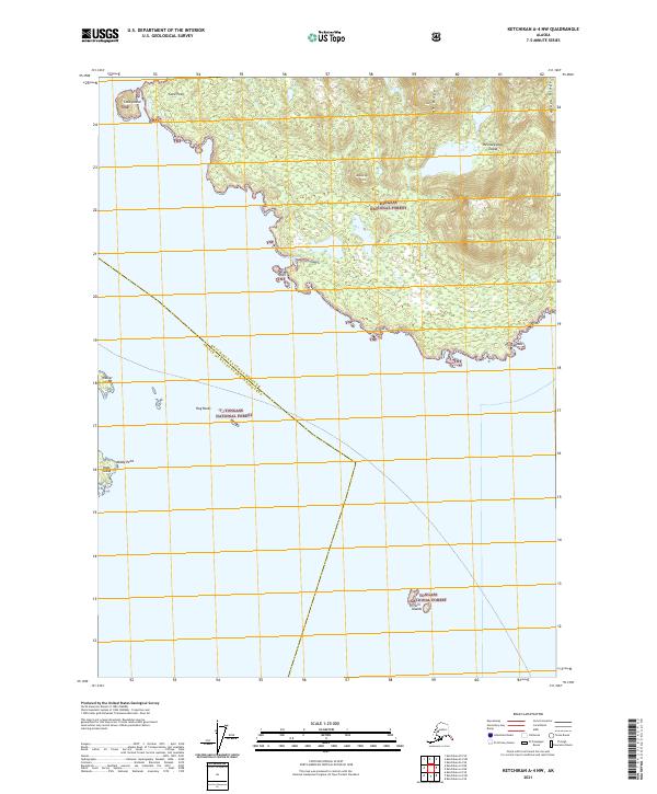
2021 Map of Ketchikan A-4 NW
USGS Topo · Published 2021About this map
Revillagigedo Island defines the northern coastline of this maritime landscape, where the steep elevations of Alava Ridge and Saw Ridge overlook the waters of the Alexander Archipelago. This modern survey illustrates the complex jurisdictional boundaries of the region, specifically where the Tongass National Forest meets the Annette Island Reserve. The map details the jagged shoreline of the southern tip of the island, extending from Cone Point in the west to Point Alava in the east.
Find a feature on this map
22 named features on this map. Tap any name to fly to it.
Don’t see what you’re looking for? This feature index may not catch every label — zoom into the map to look around manually.
Map Details
Editions of this 2021 Ketchikan A-4 NW Map
This is the sole edition of this map. No revisions or reprints were ever made.
Other maps of this area

1949 · Ketchikan B-4
USGS Topo · 1:63,360

1952 · Ketchikan
USGS Topo · 1:250,000

1952 · Ketchikan B-4
USGS Topo · 1:63,360

1954 · Ketchikan B-5
USGS Topo · 1:63,360

1955 · Ketchikan A-4
USGS Topo · 1:63,360

1955 · Ketchikan A-5
USGS Topo · 1:63,360

1955 · Ketchikan
USGS Topo · 1:250,000

1955 · Ketchikan B-5
USGS Topo · 1:63,360
1994 · Ketchikan B-5
USGS Topo · 1:63,360
1995 · Ketchikan B-4
USGS Topo · 1:63,360