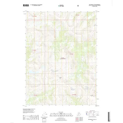
2018 Map of Ketchikan B-1 NW
USGS Topo · Published 2018About this map
The Tongass National Forest dominates this Alaskan landscape, where the Rousseau Range cuts across the southern terrain. This 2018 survey provides a precise look at the interior topography of the Ketchikan Gateway Borough, characterized by extreme elevation changes and complex water systems. Dome Peak stands as a primary landmark in the southeast, serving as a clear orientation point for those navigating the high country. The absence of roads or permanent settlements within this portion of the forest underscores the wilderness character of the region, emphasizing its status as a managed timber and ecological reserve. Topographic contours illustrate the deep drainages and sharp ridgelines typical of the Alexander Archipelago's coastal mountains.
Find a feature on this map
9 named features on this map. Tap any name to fly to it.
Don’t see what you’re looking for? This feature index may not catch every label — zoom into the map to look around manually.
Map Details
Editions of this 2018 Ketchikan B-1 NW Map
This is the sole edition of this map. No revisions or reprints were ever made.
Other maps of this area

1952 · Ketchikan
USGS Topo · 1:250,000

1955 · Ketchikan C-2
USGS Topo · 1:63,360

1955 · Ketchikan B-2
USGS Topo · 1:63,360

1955 · Ketchikan B-1
USGS Topo · 1:63,360

1955 · Ketchikan C-1
USGS Topo · 1:63,360

1955 · Ketchikan
USGS Topo · 1:250,000

1996 · Ketchikan C-2
USGS Topo · 1:63,360
2018 · Ketchikan B-1 NE
USGS Topo · 1:25,000
2018 · Ketchikan B-2 NE
USGS Topo · 1:25,000
2018 · Ketchikan B-2 SE
USGS Topo · 1:25,000