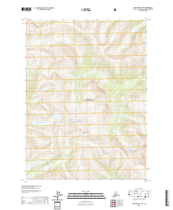
2021 Map of Ketchikan B-1 NW
USGS Topo · Published 2021About this map
Tongass National Forest dominates this Alaskan landscape, where the high elevations of the Rousseau Range and the prominent summit of Dome Peak define the wilderness interior. The terrain is characterized by steep contour gradients and an extensive network of alpine wetlands and small high-altitude lakes, typical of the Ketchikan Gateway region. As a modern survey, it utilizes a combination of Gnis data and the National Hydrography Dataset to map the complex drainage patterns and glacial features of the area. The map is primarily an environmental study of the uninhabited national forest, focusing on the natural topography and the legal boundaries of the Public Land Survey System, including sections within t74s r100e and surrounding townships.
Find a feature on this map
9 named features on this map. Tap any name to fly to it.
Don’t see what you’re looking for? This feature index may not catch every label — zoom into the map to look around manually.
Map Details
Editions of this 2021 Ketchikan B-1 NW Map
This is the sole edition of this map. No revisions or reprints were ever made.
Other maps of this area

1952 · Ketchikan
USGS Topo · 1:250,000

1955 · Ketchikan C-2
USGS Topo · 1:63,360

1955 · Ketchikan B-2
USGS Topo · 1:63,360

1955 · Ketchikan B-1
USGS Topo · 1:63,360

1955 · Ketchikan C-1
USGS Topo · 1:63,360

1955 · Ketchikan
USGS Topo · 1:250,000

1996 · Ketchikan C-2
USGS Topo · 1:63,360
2018 · Ketchikan B-1 NE
USGS Topo · 1:25,000
2018 · Ketchikan B-2 NE
USGS Topo · 1:25,000
2018 · Ketchikan B-2 SE
USGS Topo · 1:25,000