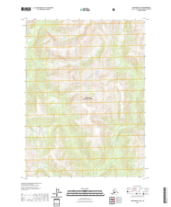
2021 Map of Ketchikan B-2 NE
USGS Topo · Published 2021About this map
Blossom River and Keta River define the vertical drainages of this landscape within the southeastern reaches of the Tongass National Forest. The terrain is marked by significant topographic relief, where water systems like Red Cr flow through deep-cut valleys. Aside from the natural waterways, the only indicated human infrastructure is the Quartz Hill Access road, which provides a corridor through the mountainous interior in the southwestern portion of the sheet. This recent survey reflects the persistent character of this region as a protected wilderness, managed by the Tongass National Forest and characterized by its dense network of rivers and glacial-carved ridges.
Find a feature on this map
11 named features on this map. Tap any name to fly to it.
Don’t see what you’re looking for? This feature index may not catch every label — zoom into the map to look around manually.
Map Details
Editions of this 2021 Ketchikan B-2 NE Map
This is the sole edition of this map. No revisions or reprints were ever made.
Other maps of this area

1952 · Ketchikan
USGS Topo · 1:250,000

1955 · Ketchikan C-2
USGS Topo · 1:63,360

1955 · Ketchikan B-2
USGS Topo · 1:63,360

1955 · Ketchikan B-1
USGS Topo · 1:63,360

1955 · Ketchikan C-1
USGS Topo · 1:63,360

1955 · Ketchikan
USGS Topo · 1:250,000

1996 · Ketchikan C-2
USGS Topo · 1:63,360
2018 · Ketchikan B-2 NE
USGS Topo · 1:25,000
2018 · Ketchikan B-2 SE
USGS Topo · 1:25,000
2018 · Ketchikan C-1 SW
USGS Topo · 1:25,000