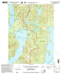
1995 Map of Ketchikan B-4
USGS Topo · Published 1999About this map
Revillagigedo Island presents a landscape shaped by coastal navigation and wilderness management during the late twentieth century. Centered within the Tongass National Forest, the map captures the administrative and industrial markers of the era, from the active Loran Radio Sta (USCG) on the western shore to a Logging Camp near Carroll Inlet. The coastal infrastructure is further detailed by the presence of a Boat Dock Oil Tank and multiple Log Transfer Facilities, indicating the ongoing importance of the timber industry and maritime transport in this part of the Ketchikan Gateway Borough.
Find a feature on this map
59 named features on this map. Tap any name to fly to it.
Don’t see what you’re looking for? This feature index may not catch every label — zoom into the map to look around manually.
Map Details
Editions of this 1995 Ketchikan B-4 Map
This is the sole edition of this map. No revisions or reprints were ever made.
Other maps of this area

1948 · Ketchikan C-5
USGS Topo · 1:63,360

1949 · Ketchikan B-4
USGS Topo · 1:63,360

1952 · Ketchikan
USGS Topo · 1:250,000

1952 · Ketchikan B-4
USGS Topo · 1:63,360

1952 · Ketchikan C-4
USGS Topo · 1:63,360

1953 · Ketchikan C-5
USGS Topo · 1:63,360

1954 · Ketchikan B-5
USGS Topo · 1:63,360

1955 · Ketchikan C-3
USGS Topo · 1:63,360

1955 · Ketchikan A-4
USGS Topo · 1:63,360

1955 · Ketchikan A-5
USGS Topo · 1:63,360