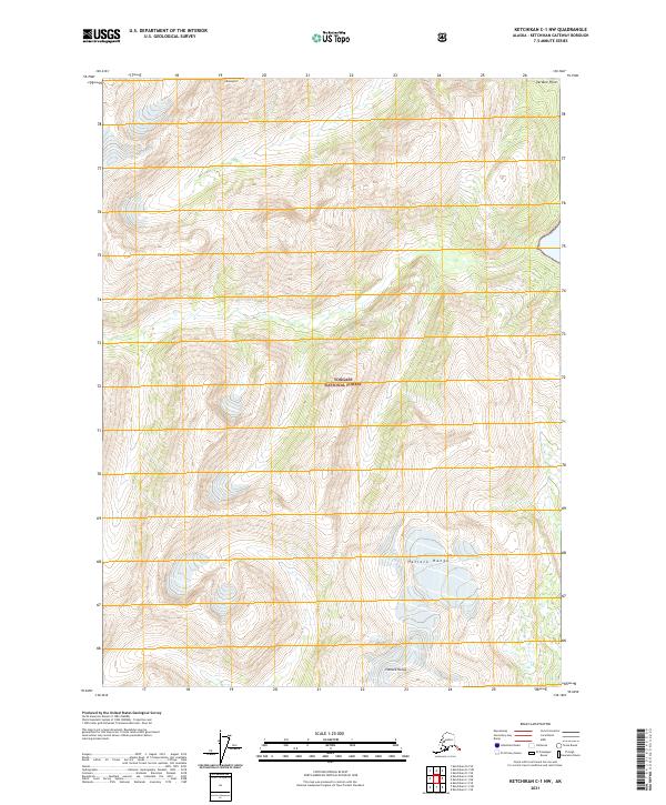
2021 Map of Ketchikan C-1 NW
USGS Topo · Published 2021About this map
The Tongass National Forest dominates this coastal Alaskan landscape, where the high ridges of the Halleck Range meet the intricate waterways of the Ketchikan Gateway Borough. This 2021 survey documents a region defined by extreme vertical relief and dense forest management, centering on the peaks of the Halleck Range and the prominent height of Mt Hayford. The map traces the rugged coastline out to Verdure Point, illustrating the interaction between the maritime environment and the mountainous interior. This specific map provides researchers with contemporary boundary data for the National Forest system, as seen in the sections of t71s r99e and t70s r98e. It serves as a clear record of the modern topography and shoreline before future glacial or environmental changes alter these remote reaches of the Alaskan panhandle.
Find a feature on this map
9 named features on this map. Tap any name to fly to it.
Don’t see what you’re looking for? This feature index may not catch every label — zoom into the map to look around manually.
Map Details
Editions of this 2021 Ketchikan C-1 NW Map
This is the sole edition of this map. No revisions or reprints were ever made.
Other maps of this area

1952 · Ketchikan
USGS Topo · 1:250,000

1955 · Ketchikan D-2
USGS Topo · 1:63,360

1955 · Ketchikan C-2
USGS Topo · 1:63,360

1955 · Ketchikan D-1
USGS Topo · 1:63,360

1955 · Ketchikan C-1
USGS Topo · 1:63,360

1955 · Ketchikan
USGS Topo · 1:250,000

1996 · Ketchikan C-2
USGS Topo · 1:63,360
1996 · Ketchikan D-2
USGS Topo · 1:63,360
2018 · Ketchikan D-2 SE
USGS Topo · 1:25,000
2018 · Ketchikan C-1 NE
USGS Topo · 1:25,000