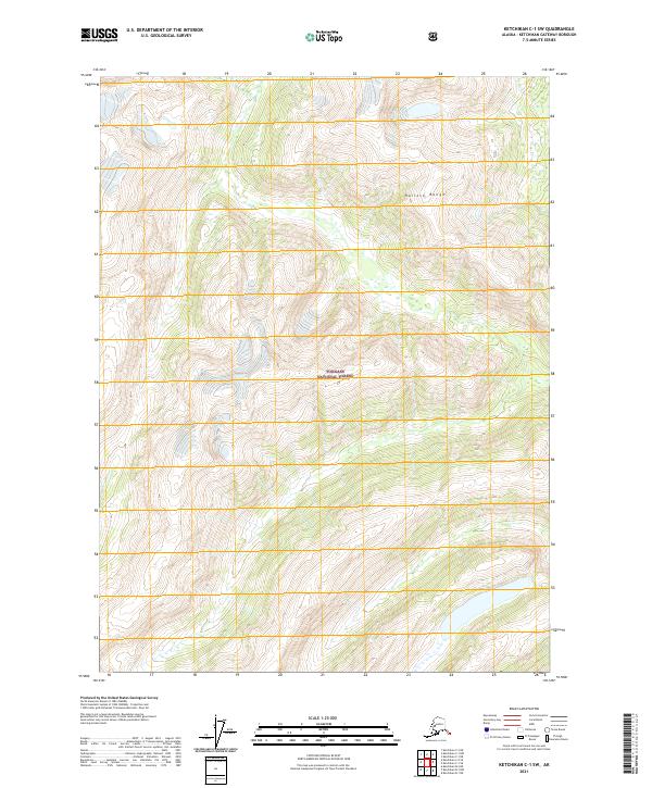
2021 Map of Ketchikan C-1 SW
USGS Topo · Published 2021About this map
Tongass National Forest dominates this section of southeast Alaska, where the high ridges of the Halleck Range define the interior terrain. The landscape is characterized by steep elevation changes and dense drainage patterns, primarily flowing toward the Keta River in the southwestern quadrant. This map offers a high-resolution look at the undeveloped wilderness and timberlands managed by the U.S. Forest Service at the start of the 2020s. Without roads or permanent settlements appearing on the sheet, the map serves as a primary reference for the natural hydrology and topographical survey boundaries of the Ketchikan Gateway Borough region.
Find a feature on this map
7 named features on this map. Tap any name to fly to it.
Don’t see what you’re looking for? This feature index may not catch every label — zoom into the map to look around manually.
Map Details
Editions of this 2021 Ketchikan C-1 SW Map
This is the sole edition of this map. No revisions or reprints were ever made.
Other maps of this area

1952 · Ketchikan
USGS Topo · 1:250,000

1955 · Ketchikan C-2
USGS Topo · 1:63,360

1955 · Ketchikan B-2
USGS Topo · 1:63,360

1955 · Ketchikan B-1
USGS Topo · 1:63,360

1955 · Ketchikan C-1
USGS Topo · 1:63,360

1955 · Ketchikan
USGS Topo · 1:250,000

1996 · Ketchikan C-2
USGS Topo · 1:63,360
2018 · Ketchikan B-1 NE
USGS Topo · 1:25,000
2018 · Ketchikan B-2 NE
USGS Topo · 1:25,000
2018 · Ketchikan C-1 NE
USGS Topo · 1:25,000