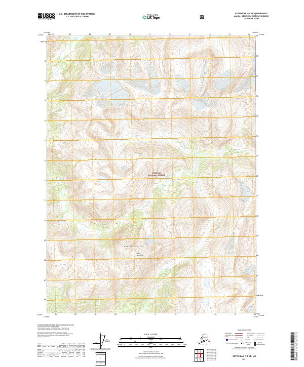
2021 Map of Ketchikan C-2 NE
USGS Topo · Published 2021About this map
The Adam Mountains dominate this high-altitude Alaskan terrain within the expansive boundaries of the Tongass National Forest. In this remote landscape, the drainage patterns of the Wilson River and the Blossom River illustrate the complex watershed geography of the Ketchikan region. The lack of modern road infrastructure or named settlements on this 2021 survey emphasizes the area's preserved natural state, defined primarily by steep elevation changes and the protected status of the national forest. Public land survey system notations including t71s r97e and t71s r98e provide a grid for locating specific topographic landmarks within this undeveloped wilderness.
Find a feature on this map
9 named features on this map. Tap any name to fly to it.
Don’t see what you’re looking for? This feature index may not catch every label — zoom into the map to look around manually.
Map Details
Editions of this 2021 Ketchikan C-2 NE Map
This is the sole edition of this map. No revisions or reprints were ever made.
Other maps of this area

1952 · Ketchikan
USGS Topo · 1:250,000

1955 · Ketchikan D-2
USGS Topo · 1:63,360

1955 · Ketchikan C-2
USGS Topo · 1:63,360

1955 · Ketchikan D-1
USGS Topo · 1:63,360

1955 · Ketchikan C-1
USGS Topo · 1:63,360

1955 · Ketchikan
USGS Topo · 1:250,000

1996 · Ketchikan C-2
USGS Topo · 1:63,360
1996 · Ketchikan D-2
USGS Topo · 1:63,360
2018 · Ketchikan D-2 SE
USGS Topo · 1:25,000
2018 · Ketchikan C-1 SW
USGS Topo · 1:25,000