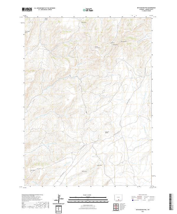
2021 Map of Ketchum Buttes
USGS Topo · Published 2021About this map
Ketchum Buttes and the surrounding high desert topography of Carbon County dominate this landscape, characterized by a complex network of draws and seasonal drainages. The area is defined by its prominent landforms, including Cow Creek Butte, Lone Butte, and the distinctive Rendle Rim near Rendle Butte. These geological features provide essential landmarks for navigating the vast terrain between the various forks of the local waterways.
Find a feature on this map
21 named features on this map. Tap any name to fly to it.
Don’t see what you’re looking for? This feature index may not catch every label — zoom into the map to look around manually.
Map Details
Editions of this 2021 Ketchum Buttes Map
This is the sole edition of this map. No revisions or reprints were ever made.
Other maps of this area

1932 · Savery
USGS Topo · 1:96,000

1940 · Savery
USGS Topo · 1:125,000

1954 · Rawlins
USGS Topo · 1:250,000

1957 · Baggs
USGS Topo · 1:62,500

1957 · Doty Mountain
USGS Topo · 1:62,500

1958 · Rawlins
USGS Topo · 1:250,000

1961 · Pine Grove Ranch
USGS Topo · 1:24,000
1961 · Browns Hill
USGS Topo · 1:24,000

1961 · Ketchum Buttes
USGS Topo · 1:24,000

1961 · Pole Gulch
USGS Topo · 1:24,000