
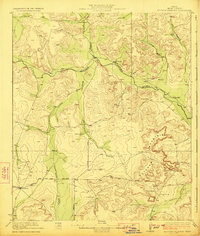
1923 Map of Ketchum Mountain
USGS Topo · Published 1923About this map
Ketchum Mountain dominates the eastern horizon of this West Texas landscape, as documented in a survey directed by J.A. Udden for the Bureau of Economic Geology and Technology. This region of Irion County is defined by its expansive ranching operations, where water security is a primary concern as evidenced by numerous wells scattered across the drainage basins. The Middle Concho River and And Concho River flow through the territory, joined by intermittent seasonal features like Kiowa Creek, Liveoak Draw, and Bradford Draw.
Find a feature on this map
24 named features on this map. Tap any name to fly to it.
Don’t see what you’re looking for? This feature index may not catch every label — zoom into the map to look around manually.
Map Details
Editions of this 1923 Ketchum Mountain Map
2 editions found
Other maps of this area

1895 · Sherwood
USGS Topo · 1:125,000

1920 · Big Lake
USGS Topo · 1:62,500

1920 · Barnhart
USGS Topo · 1:62,500

1921 · Ketchum Mountain
USGS Topo · 1:62,500

1922 · Big Lake
USGS Topo · 1:62,500

1922 · Barnhart
USGS Topo · 1:62,500

1954 · San Angelo
USGS Topo · 1:250,000

1958 · San Angelo
USGS Topo · 1:250,000

1965 · San Angelo
USGS Topo · 1:250,000

1970 · South Mustang Draw SE
USGS Topo · 1:24,000