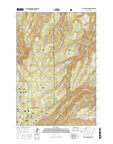
2017 Map of Ketchum Reservoir
USGS Topo · Published 2017About this map
Mount Hood National Forest defines this high-elevation landscape on the border of Hood River and Wasco counties. The terrain is a complex of volcanic ridges and deep canyons, including Mill Creek Ridge and Woods Backbone, which channel a network of drainages like Rock Cr and W Fork Mosier Cr. Cultural history is anchored by water management and early forestry, evidenced by the Sky Ranch Reservoir Number Three and the namesake Ketchum Reservoir. The presence of Old Schoolhouse Spring and Schoolman Spring suggests early localized use of reliable water sources in this dry, timbered country. Transportation follows the rugged topography, with Ketchum Rd and Mill Creek Lookout Rd providing access across Sheldon Ridge and Breeds Flat. The map documents a transition between active forest management and conservation, where former logging sites like Baker Canyon sit alongside protected wilderness areas near Fir Mountain.
Find a feature on this map
57 named features on this map. Tap any name to fly to it.
Don’t see what you’re looking for? This feature index may not catch every label — zoom into the map to look around manually.
Map Details
Editions of this 2017 Ketchum Reservoir Map
This is the sole edition of this map. No revisions or reprints were ever made.
Other maps of this area

1924 · Mount Hood
USGS Topo · 1:125,000

1926 · Hood River
USGS Topo · 1:125,000

1927 · Mount Hood
USGS Topo · 1:125,000

1929 · Hood River
USGS Topo · 1:125,000

1930 · Dufur
USGS Topo · 1:125,000

1934 · Dufur
USGS Topo · 1:125,000

1934 · The Dalles
USGS Topo · 1:125,000

1953 · The Dalles
USGS Topo · 1:250,000

1956 · The Dalles
USGS Topo · 1:250,000

1957 · The Dalles
USGS Topo · 1:250,000