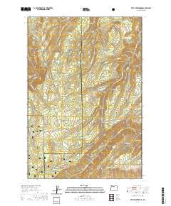
2020 Map of Ketchum Reservoir
USGS Topo · Published 2020About this map
The boundary between Hood River and Wasco counties cuts through this high-elevation terrain, where water sources were critical for early mountain settlement and grazing. Evidence of former community infrastructure appears at Old Schoolhouse Spring, a site hinting at the remote education once necessary in these hills. The landscape is defined by its drainages, including the headwaters of Mosier Cr and W Fork Mosier Cr, which descend from high ridges like Woods Backbone and Mill Creek Ridge.
Find a feature on this map
57 named features on this map. Tap any name to fly to it.
Don’t see what you’re looking for? This feature index may not catch every label — zoom into the map to look around manually.
Map Details
Editions of this 2020 Ketchum Reservoir Map
This is the sole edition of this map. No revisions or reprints were ever made.
Other maps of this area

1924 · Mount Hood
USGS Topo · 1:125,000

1926 · Hood River
USGS Topo · 1:125,000

1927 · Mount Hood
USGS Topo · 1:125,000

1929 · Hood River
USGS Topo · 1:125,000

1930 · Dufur
USGS Topo · 1:125,000

1934 · Dufur
USGS Topo · 1:125,000

1934 · The Dalles
USGS Topo · 1:125,000

1953 · The Dalles
USGS Topo · 1:250,000

1956 · The Dalles
USGS Topo · 1:250,000

1957 · The Dalles
USGS Topo · 1:250,000