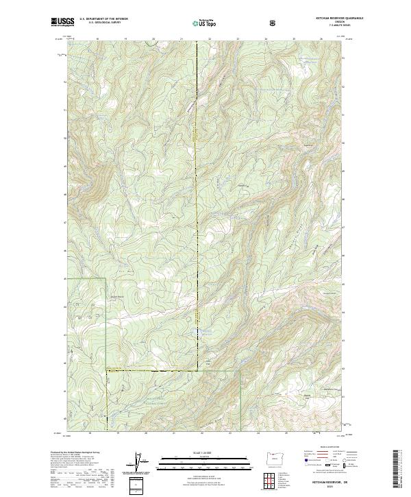
2023 Map of Ketchum Reservoir
USGS Topo · Published 2023About this map
Ketchum Reservoir sits at the heart of this high-elevation landscape, where the rugged terrain of the Mount Hood National Forest meets the ridges of Wasco and Hood River counties. The area is defined by a series of high flats and prairies, such as Willow Flat, Round Prairie, and Pine Flat, which suggest a history of seasonal grazing or early upland settlement. Drainage systems like Mosier Creek and the North Fork Mill Creek carve through the prominent elevations of Sheldon Ridge and Mill Creek Ridge. Local landmarks like Old Schoolhouse Spring and the Sky Ranch Reservoir Number Three provide specific points of interest for those tracing the development of water resources and rural infrastructure in this part of Oregon. The map illustrates a complex network of forest roads, including Ketchum Rd and Fir Mountain Rd, navigating the steep transitions between canyons and peaks.
Find a feature on this map
56 named features on this map. Tap any name to fly to it.
Don’t see what you’re looking for? This feature index may not catch every label — zoom into the map to look around manually.
Map Details
Editions of this 2023 Ketchum Reservoir Map
This is the sole edition of this map. No revisions or reprints were ever made.
Other maps of this area

1924 · Mount Hood
USGS Topo · 1:125,000

1926 · Hood River
USGS Topo · 1:125,000

1927 · Mount Hood
USGS Topo · 1:125,000

1929 · Hood River
USGS Topo · 1:125,000

1930 · Dufur
USGS Topo · 1:125,000

1934 · Dufur
USGS Topo · 1:125,000

1934 · The Dalles
USGS Topo · 1:125,000

1953 · The Dalles
USGS Topo · 1:250,000

1956 · The Dalles
USGS Topo · 1:250,000

1957 · The Dalles
USGS Topo · 1:250,000