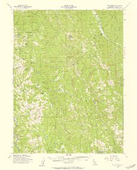
1955 Map of Kettenpom
USGS Topo · Published 1957About this map
The Mad River and its numerous forks carve through this section of the Six Rivers National Forest in the mid-1950s. High ridges such as Bradburn Ridge and Horse Ridge overlook a landscape dotted with remote ranches and small mountain settlements. The isolated community of Kettenpom sits within the Kettenpom Valley, supported by a nearby Landing Strip. Further south, the map details the Island Mtn Mine near the banks of the river, a notable industrial site in an otherwise agricultural and timbered region.
Find a feature on this map
73 named features on this map. Tap any name to fly to it.
Don’t see what you’re looking for? This feature index may not catch every label — zoom into the map to look around manually.
Map Details
Editions of this 1955 Kettenpom Map
3 editions found
Other maps of this area

1918 · Anada
USGS Topo · 1:62,500

1920 · Cummings
USGS Topo · 1:62,500

1920 · Covelo
USGS Topo · 1:62,500

1920 · Harris
USGS Topo · 1:62,500

1921 · Hoaglin
USGS Topo · 1:62,500

1922 · Island Mountain
USGS Topo · 1:62,500

1926 · Covelo
USGS Topo · 1:62,500

1931 · Hoaglin
USGS Topo · 1:96,000

1935 · Hoaglin
USGS Topo · 1:125,000

1949 · Blocksburg
USGS Topo · 1:62,500