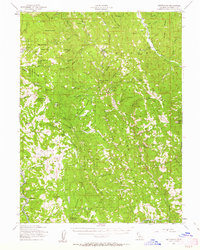
1955 Map of Kettenpom
USGS Topo · Published 1963About this map
Zenia and the surrounding ranching landscape of southern Trinity County are captured here following a 1955 field check by the U.S. Geological Survey. The map reveals a remote mountainous interior dominated by the Six Rivers National Forest, where life centered around the Kettenpom Valley and the Hoaglin Valley. Numerous family-named homesteads and operational sites are documented, including the Gillman Ranch, Lampley Ranch, and the Zenia Guard Sta. Educational and public facilities like the Hoaglin Sch and a Landing Strip near Kettenpom suggest the infrastructure required to support these isolated communities.
Find a feature on this map
63 named features on this map. Tap any name to fly to it.
Don’t see what you’re looking for? This feature index may not catch every label — zoom into the map to look around manually.
Map Details
Editions of this 1955 Kettenpom Map
3 editions found
Other maps of this area

1918 · Anada
USGS Topo · 1:62,500

1920 · Cummings
USGS Topo · 1:62,500

1920 · Covelo
USGS Topo · 1:62,500

1920 · Harris
USGS Topo · 1:62,500

1921 · Hoaglin
USGS Topo · 1:62,500

1922 · Island Mountain
USGS Topo · 1:62,500

1926 · Covelo
USGS Topo · 1:62,500

1931 · Hoaglin
USGS Topo · 1:96,000

1935 · Hoaglin
USGS Topo · 1:125,000

1949 · Blocksburg
USGS Topo · 1:62,500