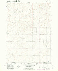
1964 Map of Kettle Butte NE
USGS Topo · Published 1979About this map
Arid agricultural and ranching lands straddle the border of Jefferson and Bonneville counties in this mid-century topographic record. The landscape is defined by its reliance on groundwater, evidenced by a network of numbered wells such as Well 4981 and Well 4936 that support the high-desert terrain. Transportation and logistics are catered to by a remote Landing Strip and an isolated Corral, reflecting the industrial and ranching infrastructure necessary for survival in this part of Idaho. The Kettle Butte Drain provides a rare glimpse into the local drainage patterns that define the southeastern portion of the map. While the terrain is relatively uniform, these specific improvements highlight the human effort to manage water and logistics across these high elevations during the 1960s and 1970s.
Find a feature on this map
14 named features on this map. Tap any name to fly to it.
Don’t see what you’re looking for? This feature index may not catch every label — zoom into the map to look around manually.
Map Details
Editions of this 1964 Kettle Butte NE Map
2 editions found
Other maps of this area

1949 · Roberts
USGS Topo · 1:62,500

1949 · Roberts
USGS Topo · 1:24,000

1949 · Shattuck Butte
USGS Topo · 1:24,000

1950 · Shattuck Butte
USGS Topo · 1:24,000

1950 · Roberts
USGS Topo · 1:24,000

1955 · Idaho Falls
USGS Topo · 1:250,000

1958 · Idaho Falls
USGS Topo · 1:250,000

1964 · Kettle Butte NE
USGS Topo · 1:24,000

1964 · Kettle Butte NW
USGS Topo · 1:24,000

1964 · Kettle Butte SW
USGS Topo · 1:24,000