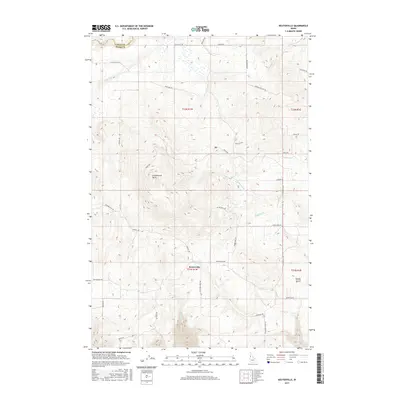
2017 Map of Keuterville
USGS Topo · Published 2017About this map
Keuterville serves as the central hub of this Idaho County landscape, situated on a high plateau defined by agricultural tracts and a network of named roads. The area is dominated by the prominent elevation of Cottonwood Butte to the northwest, with the terrain dropping away into steep drainages such as Hanley Gulch and the canyon formed by Lawyer Cr. The road names themselves, such as Hussman Mill Rd, Monastery Rd, and St Michaels Rd, suggest a history of local industry and religious settlement. Numerous watercourses, including Cottonwood Cr, Shebang Cr, and Grave Cr, carve through the rolling surface, indicating a complex watershed that drains from the heights down toward the Clearwater River basin. This survey provides a clear view of the rural infrastructure, from the Keuterville Rd corridor to the isolated reaches of Icicle Flat Rd.
Find a feature on this map
41 named features on this map. Tap any name to fly to it.
Don’t see what you’re looking for? This feature index may not catch every label — zoom into the map to look around manually.
Map Details
Editions of this 2017 Keuterville Map
This is the sole edition of this map. No revisions or reprints were ever made.
Other maps of this area

1924 · Kamiah
USGS Topo · 1:125,000

1955 · Pullman
USGS Topo · 1:250,000

1955 · Grangeville
USGS Topo · 1:250,000

1958 · Pullman
USGS Topo · 1:250,000

1959 · Grangeville
USGS Topo · 1:250,000

1963 · Boles
USGS Topo · 1:24,000

1963 · Moughmer Point
USGS Topo · 1:24,000
1963 · Fenn
USGS Topo · 1:24,000

1967 · Craigmont
USGS Topo · 1:24,000

1967 · Westlake
USGS Topo · 1:24,000