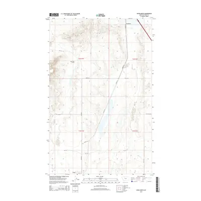
2014 Map of Kevin North
USGS Topo · Published 2014About this map
Sunburst and Kevin anchor the northern and southern edges of this Montana landscape in Toole County. The terrain is defined by a grid of rural and industrial access routes, including Sunburst Rd and Kevin Rd N, which traverse the high plains between the townships. A distinctive drainage pattern is formed by Alkali Flat Coulee, while local history is etched into the naming of secondary paths such as Maggie Ward Rd and Hesla Rd. The map also highlights the infrastructure of the energy industry and rural land management through labels like W Nutter Lease Rd and Fed Pit Rd. This 2014 survey captures the persistent layout of section lines and the sparsely populated expanses of the northern frontier, providing a clear view of the transportation network connecting these two small communities.
Find a feature on this map
15 named features on this map. Tap any name to fly to it.
Don’t see what you’re looking for? This feature index may not catch every label — zoom into the map to look around manually.
Map Details
Editions of this 2014 Kevin North Map
This is the sole edition of this map. No revisions or reprints were ever made.
Other maps of this area

1909 · Cut Bank
USGS Topo · 1:125,000

1912 · Cut Bank
USGS Topo · 1:125,000

1939 · Sunburst
USGS Topo · 1:62,500

1943 · Shelby
USGS Topo · 1:62,500

1954 · Shelby
USGS Topo · 1:250,000

1958 · Shelby
USGS Topo · 1:250,000

1960 · Cut Bank
USGS Topo · 1:250,000

1963 · Cut Bank
USGS Topo · 1:250,000

1964 · Cut Bank
USGS Topo · 1:250,000
1966 · Aloe
USGS Topo · 1:24,000