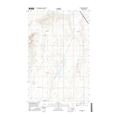
2017 Map of Kevin North
USGS Topo · Published 2017About this map
The town of Kevin anchors the southern edge of this Montana landscape in Toole County, where the plains are defined by a grid of rural roads and drainage patterns. The terrain is marked by the Alkali Flat Coulee, a significant geographical feature cutting through the western sections of the quadrangle. Transport and infrastructure are centered around corridors like S Railroad Ave and Sunburst Rd, reflecting the region's reliance on rail and road networks for its agricultural and industrial needs.
Find a feature on this map
17 named features on this map. Tap any name to fly to it.
Don’t see what you’re looking for? This feature index may not catch every label — zoom into the map to look around manually.
Map Details
Editions of this 2017 Kevin North Map
This is the sole edition of this map. No revisions or reprints were ever made.
Other maps of this area

1909 · Cut Bank
USGS Topo · 1:125,000

1912 · Cut Bank
USGS Topo · 1:125,000

1939 · Sunburst
USGS Topo · 1:62,500

1943 · Shelby
USGS Topo · 1:62,500

1954 · Shelby
USGS Topo · 1:250,000

1958 · Shelby
USGS Topo · 1:250,000

1960 · Cut Bank
USGS Topo · 1:250,000

1963 · Cut Bank
USGS Topo · 1:250,000

1964 · Cut Bank
USGS Topo · 1:250,000
1966 · Aloe
USGS Topo · 1:24,000