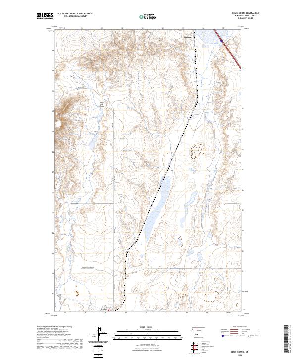
2024 Map of Kevin North
USGS Topo · Published 2024About this map
Sunburst and the northern edge of Kevin anchor this Toole County landscape, where the high plains of Montana meet a network of rural transit and natural drainage. The terrain is defined by the winding path of Alkali Flat Coulee, which carves through the township boundaries of t36n r3w, t36n r2w, and their southern counterparts. This area highlights the intersection of industrial access and residential life, characterized by the presence of Gravel Pit Access Rd alongside named local routes like Maggie Ward and Hesla Rd. The layout of S Railroad Ave in Sunburst points to the historical importance of the rail corridor in moving goods through this border region. This survey offers a clear view of the modern land divisions and water features that have sustained this prairie community.
Find a feature on this map
18 named features on this map. Tap any name to fly to it.
Don’t see what you’re looking for? This feature index may not catch every label — zoom into the map to look around manually.
Map Details
Editions of this 2024 Kevin North Map
This is the sole edition of this map. No revisions or reprints were ever made.
Other maps of this area

1909 · Cut Bank
USGS Topo · 1:125,000

1912 · Cut Bank
USGS Topo · 1:125,000

1939 · Sunburst
USGS Topo · 1:62,500

1943 · Shelby
USGS Topo · 1:62,500

1954 · Shelby
USGS Topo · 1:250,000

1958 · Shelby
USGS Topo · 1:250,000

1960 · Cut Bank
USGS Topo · 1:250,000

1963 · Cut Bank
USGS Topo · 1:250,000

1964 · Cut Bank
USGS Topo · 1:250,000
1966 · Aloe
USGS Topo · 1:24,000