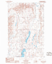
1986 Map of Kevin North
USGS Topo · Published 1986About this map
The Sunburst and Kevin communities anchor this high-plains landscape in Toole County, where the industrial footprint of the energy sector is etched across the terrain. Extensive Oil Field developments and numerous Oil Wells define the local economy, supported by infrastructure like the Burlington Northern railroad and a network of pipelines. The presence of a Tank Farm (Abandoned) near Sunburst hints at the shifting cycles of the oil industry by the mid-1980s.
Find a feature on this map
13 named features on this map. Tap any name to fly to it.
Don’t see what you’re looking for? This feature index may not catch every label — zoom into the map to look around manually.
Map Details
Editions of this 1986 Kevin North Map
This is the sole edition of this map. No revisions or reprints were ever made.
Other maps of this area

1909 · Cut Bank
USGS Topo · 1:125,000

1912 · Cut Bank
USGS Topo · 1:125,000

1939 · Sunburst
USGS Topo · 1:62,500

1943 · Shelby
USGS Topo · 1:62,500

1954 · Shelby
USGS Topo · 1:250,000

1958 · Shelby
USGS Topo · 1:250,000

1960 · Cut Bank
USGS Topo · 1:250,000

1963 · Cut Bank
USGS Topo · 1:250,000

1964 · Cut Bank
USGS Topo · 1:250,000
1966 · Aloe
USGS Topo · 1:24,000