
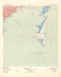
1949 Map of Key Biscayne
USGS Topo · Published 1949About this map
Brickell Hammock and the waterfront neighborhoods of Coconut Grove and Silver Bluff anchor the mainland portion of this coastal survey. The mid-century maritime character of the area is evident in the concentration of facilities like the US Coast Guard Air Station, the Biscayne Yacht Club, and the Pan-American terminal at Dinner Key Park. Offshore, the Rickenbacker Causeway provides the critical link to Virginia Beach and Biscayne Key, where the landscape is defined by Crandon Park and the undeveloped southern reach leading to Cape Florida.
Find a feature on this map
46 named features on this map. Tap any name to fly to it.
Don’t see what you’re looking for? This feature index may not catch every label — zoom into the map to look around manually.
Map Details
Editions of this 1949 Key Biscayne Map
2 editions found
Other maps of this area

1947 · Key Biscayne
USGS Topo · 1:24,000

1948 · Soldier Key
USGS Topo · 1:24,000

1949 · Perrine
USGS Topo · 1:24,000

1950 · Hialeah
USGS Topo · 1:24,000

1950 · Miami
USGS Topo · 1:24,000

1950 · South Miami
USGS Topo · 1:24,000

1956 · Perrine
USGS Topo · 1:24,000

1956 · South Miami
USGS Topo · 1:24,000
1956 · Soldier Key
USGS Topo · 1:24,000

1956 · Miami
USGS Topo · 1:250,000