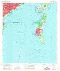
1962 Map of Key Biscayne
USGS Topo · Published 1971About this map
Virginia Key and the growing village of Key Biscayne anchor this survey of the barrier islands and mainland shores before the 1970s. Connected to Miami via the Rickenbacker Causeway, these keys show a mix of early tourism and critical maritime infrastructure. The northern tip of Virginia Key is dominated by industrial and recreational sites including a sewage disposal plant near the Seaquarium and Marine Stadium. Southward, the massive Crandon County Park covers much of Key Biscayne, including an expansive Golf Course and several parking areas that denote the area's mid-century rise as a destination. On the mainland, the map details the established neighborhoods of Coconut Grove and South Bay Estates, featuring landmarks like the Viscaya Museum and the U S Coast Guard Air Station at Dinner Key. The southern terminus at Cape Florida preserves the Cape Florida Old Lighthouse Tower, marking the historic entrance to the Biscayne Channel.
Find a feature on this map
65 named features on this map. Tap any name to fly to it.
Don’t see what you’re looking for? This feature index may not catch every label — zoom into the map to look around manually.
Map Details
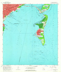
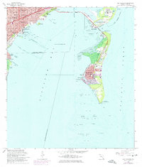
Editions of this 1962 Key Biscayne Map
3 editions found
Other maps of this area

1947 · Key Biscayne
USGS Topo · 1:24,000

1948 · Soldier Key
USGS Topo · 1:24,000

1949 · Key Biscayne
USGS Topo · 1:24,000

1949 · Perrine
USGS Topo · 1:24,000

1950 · Hialeah
USGS Topo · 1:24,000

1950 · Miami
USGS Topo · 1:24,000

1950 · South Miami
USGS Topo · 1:24,000

1956 · Perrine
USGS Topo · 1:24,000

1956 · South Miami
USGS Topo · 1:24,000
1956 · Soldier Key
USGS Topo · 1:24,000